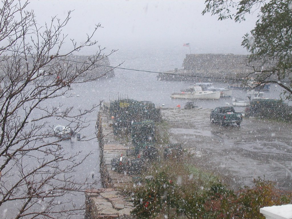
Hurricane Wilma is heading up the east coast far offshore, but will look like a nor'easter to New England. We've had steady rain and some wind this morning, but it is slated to get worse by late morning. The temperature is mild (50 degrees), so if we lose power, it won't be a disaster. Better to get the weak tree limbs down now instead in the middle of a blizzard.
Flood Watch / Flood Statement Expires 12:45 PM EDT on October 25, 2005
Statement as of 4:44 AM EDT on October 25, 2005
... Flood Watch remains in effect through this evening for Rhode Island
and much of the eastern half of Massachusetts exclusive of the islands...
The Flood Watch continues for
* portions of Massachusetts... central Massachusetts... eastern Massachusetts... northeast Massachusetts... southeast
Massachusetts... central Rhode Island... northern Rhode Island and southern Rhode Island... including the following areas... in
Massachusetts... eastern Norfolk MA in central Massachusetts... northern Worcester MA and southern Worcester MA in eastern Massachusetts... central Middlesex MA... northern Middlesex MA... southeast Middlesex MA... Suffolk MA and western Norfolk MA in northeast Massachusetts... eastern Essex MA and western Essex MA in southeast Massachusetts... Barnstable MA... eastern Plymouth MA... northern Bristol MA... southern Bristol MA... southern Plymouth MA and western Plymouth MA in central Rhode Island... Bristol RI... eastern Kent RI and western Kent RI in northern Rhode Island... northwest Providence RI and southeast Providence RI in southern Rhode Island... Newport RI and Washington RI.
* Through this evening
* a strong noreaster that has tapped moisture from Wilma will continue to produce occasionally heavy rain through mid afternoon in the watch area. Near record calendar day storm totals of 2 to 3 inches will be widespread with isolated 4 to 5 inch amounts possible.
* Rainfall of 3 to 3.5 inches... in a 12 to 18 hour period... would result in flooding of urban and poor drainage areas as well as some area rivers and streams. Larger rivers susceptible to flooding include tributaries of the lower Merrimack River as well as the Charles... Neponset... Blackstone and Pawtuxet rivers.
A Flood Watch means there is potential for flooding based on current forecasts. You should monitor later forecasts and be alert for possible flood warnings. Those living in areas prone to flooding should be prepared to take action should flooding develop.
High Wind Advisory Expires 11:45 AM EDT on October 25, 2005
Statement as of 3:42 AM EDT on October 25, 2005
... High Wind Warning remains in effect until 6 PM EDT this
afternoon...
A High Wind Warning remains in effect until 6 PM EDT this
afternoon.
The strong to damaging winds are likely to overspread the South Coast... cape and islands around daybreak then expand up the East Coast of Massachusetts during the morning. Sustained winds of 30 to 45 mph with gusts of 60 mph appear expected. The strongest winds are expected from late this morning into early this afternoon.
A High Wind Warning is issued when sustained winds of 40 mph are expected for at least an hour... with gusts of 58 mph or greater at any time. Damage to trees... power lines... and property are possible with wind of this magnitude. High profile vehicles are vulnerable in winds of strength and travel over some of the higher bridges in southeast New England may be very difficult during the height of the event Tuesday.
VTEC:/X.CON.KBOX.HW.W.0003.051025T0800Z-051025T2200Z/